
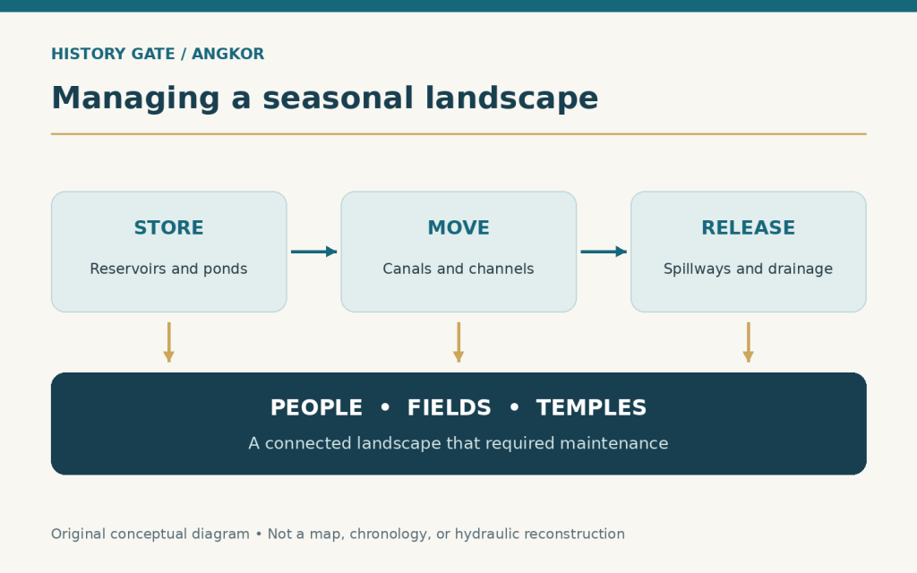
Angkor’s temple towers draw the eye upward. To understand how the city worked, look across the ground: toward reservoirs, embankments, ponds and channels. For centuries, Khmer communities reshaped this landscape to manage moving water. Its history reveals both extraordinary ingenuity and the difficulty of maintaining connections over time.
A metropolis in the spaces between
Angkor Wat is a temple; Angkor was a much larger world. In what is now northwestern Cambodia, successive Khmer capitals developed between the ninth and fifteenth centuries. The approximately 400-square-kilometre archaeological park recognised by UNESCO protects temples alongside reservoirs, dykes and canals. Those waterworks belong to the heritage just as surely as the carved stone.
The medieval settlement extended beyond that modern protected area. A 2007 archaeological mapping study, combining field surveys with remote sensing, examined nearly 3,000 square kilometres of the wider region. It identified a low-density settlement landscape linked by water-management infrastructure across more than 1,000 square kilometres. These figures describe different things: the park, the survey area and the network’s extent. They should not be treated as interchangeable measurements of one neatly bounded city.
That distinction changes the picture. Angkor’s history belongs in the broad landscape between monuments, not only inside temple walls.
Reading the ground beneath the forest
How do archaeologists investigate a city whose less durable buildings have largely disappeared? One answer is to measure the shape of the ground. In 2012, researchers used airborne laser scanning, or lidar, over parts of the Angkor region. The resulting terrain models helped reveal earthworks obscured by vegetation.
The study published in 2013 showed planned grids containing occupation mounds and ponds, extending beyond familiar enclosures. Angkor Wat fitted into an organised urban landscape rather than standing apart from ordinary life.
A terrain model records surviving shapes; it does not automatically tell us who lived on every mound or when each channel operated. Excavation and dating remain essential. The remarkable view from above gives researchers better questions to ask on the ground.
Catch it, keep it, let it go
A detailed survey of the water network identified three connected zones. Northern channels and embankments collected and redirected water arriving from the hills. Large reservoirs and temple moats occupied the central zone. Farther south, channels distributed water and carried surplus toward the Tonle Sap lake.
The giant reservoirs are called barays. The West Baray measures about eight kilometres by two kilometres. Yet size alone cannot explain the system: an outlet, a bypass or an embankment could determine where the stored or incoming water travelled next.
Managing water meant preparing for both abundance and shortage. The network could slow flows, retain water and remove excess. Agricultural and religious functions also overlapped; researchers caution against assigning every structure one exclusive purpose. A reservoir associated with a sacred landscape could still do practical work.
Nor was this a single finished plan. People added, altered and reused structures over centuries. Understanding any channel means asking how it related to its neighbours at a particular time.
The smaller ponds matter too
Royal monuments can make water management look like a story directed entirely from the palace. Archaeological research offers a more varied picture. Alongside state-sponsored infrastructure were thousands of ponds, residential mounds and community temples.
A 2020 study by Sarah Klassen and Damian Evans examined how local temple communities and major state projects developed together. Its authors describe a mixed system, combining community-level and centralised management. They also propose that the balance changed as larger, state-sponsored agricultural units became more prominent.
This matters because a water network is also a social arrangement. Someone must organise work and regulate access. The shape of a reservoir can be measured; reconstructing the relationships that kept it useful is a different, harder task. The biggest structure does not necessarily tell the whole story.
Drought was only half the problem
Evidence for past weather comes from another landscape altogether. In a 2010 climate study, researchers analysed tree rings from highland Vietnam to reconstruct regional moisture conditions. Their record indicated prolonged drought during the fourteenth and early fifteenth centuries, interrupted by exceptionally wet periods.
Tree rings are indirect evidence, not rainfall measurements made by an observer at Angkor. Their value comes from careful dating and comparison with recorded climate conditions. They help identify regional stresses that written accounts alone cannot reveal.
For a city managing seasonal water, the combination was especially difficult. Dry years threatened supplies and farming. Intense monsoons could then damage the infrastructure intended to control water. The researchers explicitly presented climate as a contributing factor alongside other pressures. A drought chronology cannot, by itself, explain political decisions or establish why a particular household moved away.
When a network transmits trouble
Connections make infrastructure useful. They can also allow damage to spread. A 2018 modelling study translated Angkor’s mapped water infrastructure into a network and tested its response to increased flows.
In the model, erosion enlarged some channels while sediment accumulated in others. Water consequently became concentrated along particular routes. Beyond a threshold, disruption spread through connected parts of the system: a cascading failure. Damage was especially important near major upstream distribution points.
This was a test of a possible mechanism, not a filmed reconstruction of one historical flood. The model simplified processes that cannot all be measured for medieval Angkor. Its significance lies in showing how extreme flows could produce more than isolated damage. It supports an explanation for vulnerability, while leaving historians to investigate how people responded, what they repaired and which other changes were already underway.
Several histories of change
Even strong evidence of hydraulic trouble does not supply a single date when Angkor stopped functioning. In research reported in 2019, sediment cores from the moat of Angkor Thom revealed declining signs of burning, erosion and forest disturbance from the early fourteenth century. By that century’s end, floating vegetation indicated reduced moat maintenance.
The researchers interpreted these changes as a gradual reduction in activity within the administrative and economic centre. This raises a difficult question about cause and effect: did failing infrastructure encourage departure, or did changing occupation and political priorities leave infrastructure with less maintenance? Both processes could interact. Evidence from one central moat should not be made to speak for every neighbourhood.
A separate excavation study at Angkor Wat found a complicated sequence of occupation. Its radiocarbon dates suggested changes in the use of residential mounds, followed by renewed activity around the late fourteenth or early fifteenth century. Angkor Wat itself was never completely abandoned. The wider history includes religious transformation, shifting political centres and regional conflict, as well as environmental pressures. Different places changed at different speeds.
A living water landscape
Water at Angkor is not only an archaeological subject. In January 2024, Cambodia’s APSARA National Authority reported releases from the West Baray for local rice irrigation. Its account described practical work on canals and water gates. This modern use should not be mistaken for proof that every medieval component worked exactly the same way. It does show that the landscape remains connected to people’s livelihoods.
Angkor invites us to look beyond spectacular buildings and dramatic endings. Its channels preserve evidence of repeated choices: where to direct water, what to maintain and how to live together across a large landscape. Understanding those choices requires several kinds of evidence, and room for explanations to change.
Featured graphic: an original Lightway Teaching Resources conceptual diagram of storing, moving, and releasing water in a connected landscape. It is not a map, chronology, or hydraulic reconstruction.
