
A star overhead, a circle of engraved metal, a turn of the hand: an astrolabe connected an observation to a model of the sky. Its ingenuity lay in making geometry something a person could operate.
One surviving example is reaching its thousandth birthday. Made by Muhammad ibn al-Ṣaffār in Córdoba, in present-day Spain, it bears a date corresponding to 1026–27 CE. Now held by National Museums Scotland, it contains seven double-sided plates for fourteen latitudes. Its moving star map was probably replaced in the thirteenth century. That later addition suggests an object adapted over time, rather than preserved exactly as it left its maker’s hands.
Putting a curved sky on a flat surface
The familiar, richly engraved version is a planispheric astrolabe. “Planispheric” points to its central trick: representing a sphere on a plane. Imagine the sky as a vast sphere surrounding an observer. The Sun and stars appear to move across it. An astrolabe translates this view into a flat arrangement that can be turned and read.
The translation uses a mathematical method called stereographic projection. In the usual arrangement, imaginary lines run from the south celestial pole through points on the sky to a flat plane through the celestial equator. Their intersections give the points’ positions on the map. As Museo Galileo explains, stars farther toward the south celestial pole project increasingly far outward, so the representation was commonly bounded at the Tropic of Capricorn. The metal face was therefore a carefully chosen map, not a picture containing every part of the sky.
Two layers, two different jobs
The instrument’s body, traditionally called the mater, held a plate marked with a local horizon and a grid of sky coordinates. Above it rotated the rete, an openwork star map. Pointers represented selected stars; an off-center circle marked the ecliptic, the Sun’s apparent yearly path. Turning this movable layer over the fixed one reproduced the changing relationship between stars and horizon. Oxford’s Epact guide to the astrolabe describes this combination as the basis of its astronomical calculations.
Latitude mattered because the sky meets the horizon differently as an observer moves north or south. An ordinary astrolabe could not simply use the same local grid everywhere. Its owner selected a suitable plate, often from several stored inside the body. Oxford’s guide to latitude plates makes the practical point: a plate useful in London would differ from one useful in Toledo. Changing plates changed the observer’s viewpoint; the star map remained above them.
First an observation, then a calculation
A user began with something measurable. Holding the instrument vertically, the observer aligned a rotating sighting rule, the alidade, with a recognizable star and read its altitude. Here altitude means an angle above the horizon, not a distance in miles. On many astrolabes, this sighting device was on the back.
The observer then turned to the model. Moving the star’s pointer to the matching altitude on the correct plate set the rete in relation to the local sky. The same arrangement revealed where other stars on the map should be. The Smithsonian’s explanation of European astrolabes distinguishes this observing-and-setting process from merely possessing a circular star chart.
Finding the time involved further information. In his treatise of about 1391, Geoffrey Chaucer first explained how to locate the Sun’s position on the zodiac using the calendar. For a night observation, he then set a star at its measured altitude on the appropriate side of the instrument and used the Sun’s position to read the hour. The date and whether the observed star lay east or west mattered. A single angle was not a complete answer waiting to be read off a dial.
A history of makers, readers, and translators
The astrolabe is poorly served by a story in which one brilliant person invents it and everyone else merely receives it. Its mathematical background reaches into Greek antiquity, but assigning the finished instrument to a particular inventor is uncertain. Museo Galileo’s historical account distinguishes the knowledge of projection associated with Hipparchus from evidence for an actual planispheric astrolabe. A mathematical idea, a buildable design, and a surviving object are different kinds of evidence.
Scholars and craftspeople in the medieval Islamic world refined the instrument and its uses. The Metropolitan Museum’s account of Islamic science and art emphasizes the influence of Islamic astrolabes on European manufacture. Knowledge traveled in writing as well as metal. The Córdoba maker’s brother, a teacher of astronomy and geometry, wrote an astrolabe treatise translated into Latin, Hebrew, and Old Spanish, according to National Museums Scotland.
Chaucer, better known today for The Canterbury Tales, made another contribution by explaining the instrument in English for a young learner. He openly acknowledged earlier authors. Understanding the astrolabe depended on people who could make its knowledge readable, as well as people who could engrave its scales.
Useful did not mean unlimited
Fine workmanship could make an instrument beautiful without making every measurement equally dependable. The Met’s astrolabe by Muhammad Zaman al-Munajjim al-Asturlabi, dated 1654–55, carries intricate calligraphy. The museum notes that instruments of this size served timekeeping well but were insufficiently precise for astronomical observation. That is a distinction between purposes, not a declaration that the instrument was useless.
Some astrolabes also displayed wealth and learning. A 1712 Iranian example in the British Museum has pointers for sixty-three stars and a gazetteer naming 103 cities. Its size and weight lead the museum to interpret it as more suited to impressive display than practical use. An instrument’s intended role cannot be inferred from elaborate markings alone.
Even the Córdoba instrument’s city labels need care: the museum’s published table shows several recorded latitudes differing from modern values. A historical scale records what its makers used, not an automatic guarantee of accuracy. Reading the object critically means asking which plate, which observation, and which degree of precision a particular task required.
The version that went to sea
The later mariner’s astrolabe was a different, simplified instrument. It retained a suspended body, an angular scale, and an alidade, rather than the planispheric instrument’s layered sky model. As the Mariners’ Museum explains, navigators measured the altitude of the Sun or a star and combined that measurement with tables to determine latitude. They did not obtain both latitude and longitude simply by turning a star map.
Heavy construction helped at sea, but a rolling vessel and strong wind still made steady readings difficult. The shared name can obscure the design change: an instrument built for several kinds of astronomical reasoning became, in its maritime form, a more specialized measuring tool.
Geometry you could move
An astrolabe rewards a second look. Its most important feature is the relationship between its parts: observation supplies a measurement, a plate supplies a viewpoint, and a movable map lets the user work out a consequence. It makes an abstract question tangible. What changes when the sky turns? What changes when the observer moves? A small mechanism could keep those questions separate and then bring them together.
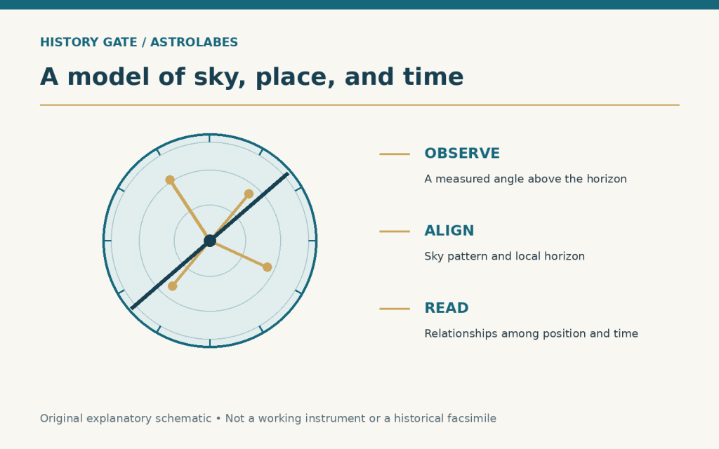
Featured graphic: an original Lightway Teaching Resources explanatory schematic linking observation, alignment, and reading. It is not a working instrument or a historical facsimile.
